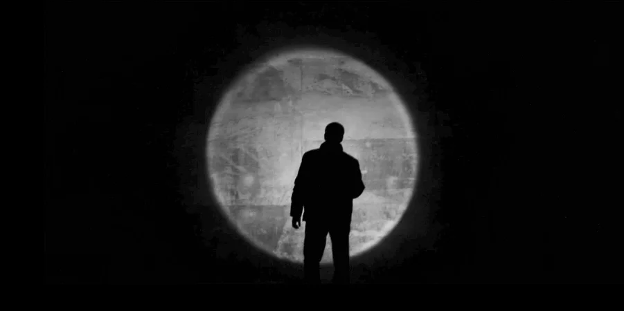

EFFUDI QUICQUID DICTAVIT GENIUS MEUS
By Julian Hunt
[Originally published in Dear Architecture, a collection of letters compiled from the Dear Architecture Competition. Dear Architecture is an ideas competition that challenged designers to explore one of the most important communication tools of all time – the letter. With entries submitted from over 60 countries around the world – the open letters challenge architects and designers to think deeply about the profession they are participating in.]

Dear Architecture,
You may have noticed I am not myself. I confess to sleeping poorly and waking with a feeling that I am becoming a device with a hard, insect-like carapace, and branched metallic antennae that pick up all the signals.
Just before waking, I dream I am an intensely complex data set illuminated inside a vast and growing self-awareness. A tiny hormonal change, la petite mort, initiates a crystallization that instantly reorganizes and locks up the entire structure.
I awaken with the memory of an explosion of a snowflake. My arms and legs, cold and tingling, are no longer my own. The room, a proper human room although a little too small, lies peacefully between its four familiar walls. A collection of textile samples lies spread out on the table - I am an architect - and above it there hangs an undecipherable drawing in a nice, gilded frame. I have a momentary clarity of vision that we are on the cusp of a great revelation. My imagination feverish, I can scarcely hold the thought.
Have we designed a gigantic and aggressive, self-organizing entity, a golem to which we shall soon become strictly subordinate? Has this assembly loosed upon the world a horrible plague of fanatical reaction? I blame myself for not having foreseen, despite my liberal education and professional training, the philosophical implications of this historic trajectory of design in human imagination. This instinctive impulse to impose an inner order, find pattern in the data, has exponentially expanded and left less and less to the outside. I look out the window at the dull weather. Drops of rain can be heard hitting the pane, which make me feel quite sad.
I comes to me at once: The architect must be a child of the devious god Hephaestus who forged an unbreakable net so fine it was invisible, designed to ensnare his promiscuous and free-spirited wife, Aphrodite. Even then, at the mythological horizon, design was already tinged with ambiguity. And later, at the dawn of modernity, in Paradise Lost, became Mulciber, the architect of palaces in heaven before his corruption and fall to become the the architect of Pandemonium, Satan’s palace, then being dismembered and scattered, leaving the field to modernity’s engineers, manufacturers of prostheses, financial fabricators, and designers of ciphered code, the DNA of our operating systems.
We were warned by the crazy poets who realized how wrong they were at the end, but we had no self-knowledge, no peripeteia. At this hour, the profession is fallen into irrelevance, reduced to a cultural metaphor and remnant as a toiling, indebted, robotic laborer in prosthetic service to the new owners of mechanisms of surveillance, anticipation, management and control.
The best we can provide is the recapture of our ancient skills of deceit, the primitive charms of the magician, by sleight-of-hand, to distract the all-seeing eye in the service of an open space, providing a means of escape outside the ever tightening net of our own design.


WATER BORDERING
By Julian Hunt
[Originally published in the print journal of cultural criticism DCENTER, November 2007]
PART 1
Ankle deep where the waters of the Anacostia and the Potomac meet, gaze south toward the Chesapeake and imagine the primeval landscape, the impenetrable forests, the limitless shoals of shad and beds of oysters. Block out the heavy backwash of the presidential helicopters banking overhead towards Bolling Air Force Base on the stripped eastern bank. Block out the intense noise from National Airport skimming over Hains Point from the far western bank. Having worked yourself around the security fence that inexplicably ended in weeds and bushwhacked through the overgrown and abandoned back yard of the hulking Coast Guard Building, you’re lucky not to have triggered a “force protection” response from nearby Ft. McNair.
Buzzard Point, so named for the buzzards attracted by the collection of fish kill and drift in the eddies of the mixing waters, has the most dramatic view of any in the metropolitan sprawl of the capital. A typically rolling, still wooded landscape shrouds any long perspective in the intimacy of leaves. Lacking the natural vistas of dramatic heights, this is the only site where the hubris of human ambition might be scaled by the simple magnitude of the landscape. But the last time anyone paid any attention to Buzzard Point was during the first twitch of Empire when the forgotten L’Enfant Plan of 1791 was revived under the McKinley Administration when the McMillan Plan of 1902, on paper, drew a grand avenue radiating south from the Capital building.
Curiously, this revival included disinterring the corpse of the designer of the plan from a pauper’s grave in Bladensburg, Maryland. Re-interred in 1909, under the name of Pierre L’Enfant, and exalted in Arlington Cemetery in the shadow of the Custis-Lee mansion, the modest tomb takes the curious form of an Empire map table with a splendid view (from Virginia) of the District across the river. The ancient practice of corpse appropriation thus allowed the name of Pierre L’Enfant entry into the American pantheon as a useful adornment to the creation of a foundation myth that the layout of the city was all so skillfully planned and divinely inspired. Attention flagged, however, wars intervened, and money was diverted before the work of the McMillan Plan was completed. The U.S. Commission of Fine Arts established in 1910 and charged with implementing the McMillan Plan never seemed very concerned with implementing the plan past the Anacostia River. The Mall filled-up with temporary military structures during the Second World War. South Capitol Street never went anywhere anyway and turned away over a bridge toward the far Anacostia neighborhoods and the Maryland suburbs beyond. By the late fifties the infrastructure of interstate highways rendered the symbolic gestures of the McMillan Plan obsolete.
DÉRIVE
Guy Debord, author of the “Society of the Spectacle” and prominent member of the Situationist International, an avantgarde group active in Paris between 1957 and 1972, is usually credited with the invention of psychogeography as a means to critique conventional ways of observing the modern city. The Situationists developed the idea of the randomly motivated walk, the “dérive” or drift, and “reverie” or “contemplation” as , an update of the nineteenth-century figure of the flaneur. The pedestrian of Housmann’s transformed Paris who wandered, idled, and watched, became a critical observer of new forms of urban fauna. Walter Benjamin, however, noted the gradual assimilation of the flaneur into specific functions within the new configuration from which new social forms emerged by the end of the 19th century: the journalist, the detective, and the female shopper. The Situationists revival of walking as an intellectual activity opened a new literary form which such writers as V.S. Naipal, W.G. Sebald, and Iain Sinclair have exploited for their observations of modern European cities and societies. Shouldn’t Washington merit similar scrutiny? Unfold a map of Washington, DC. Note that the dominant graphic figure is drawn by the convergence of the two rivers. Antique reproduction maps of the city occupy our peripheral vision. On the walls of dental clinics, conservative restaurants, behind lawyers’ desks, these maps indicate an anxiety for establishment yet, at the same time, subvert by the suggestive figure of a female anatomy: left and right fallopian tubes, swampy fecundity. At the convergence, a slight indentation where St. James Creek once flowed, overlay a sectional drawing of the opening of the uterus. The Capital Building, lies exactly north, like a fetus in the womb. This randomly motivated walk begins when a guard, somnambulant in his booth, suddenly notices a burr-covered figure emerging from the weeds that enclose Buzzard point. His homeland security training kicks-in, right-hand on holstered pistol, government-issue uniform, the guard demands a driver’s license, a now common gesture of official etiquette, before politely telling me to leave without apology or explanation. Some procurement officer must have done the paperwork that landed the Coast Guard Building here: toilet seats, architects: the same paperwork. Abuse of power comes in many forms, from thoughtless neglect and failure of imagination that result in such physical ruin as a natural landscape tortured by ugly buildings and concrete, to the physical abuse that approaches torture in the ruin of thought and the imagination necessary for empathy. Designed for somewhere else, this hulk of a container takes no notice of its locale, no acknowledgement of anything beyond the skin of the facade. A siting error has chamfered one corner of the building that was too close to the lot boundary. You can imagine the money made in change orders. Nor could the procurement official read the site plan well enough to understand the enormous quantities of water that converge, on the one side, from the lowlands of tidewater Maryland and, on the other, from the hinterlands of the Allegheny mountains. Dumpsters converge there now, blown trash leafing the trees. But if you stand there you can sense the presence of the Leviathan, the entire apparatus of government at your back, and before you the whole expanse of continental waters flow down to the bay and then to the sea.
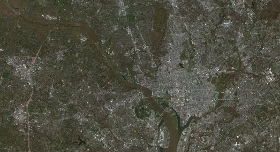
Aerial Photo, Potomac and Anacostia Rivers
An incipient uterine peninsula, Buzzard Point ends where P Street draws the north edge of an area where the “rule of law” might be imposed as a matter of nation building, simple urban decorum. A recent mayor was apprehended here outside an unregistered strip club with powder on his upper lip (or was it a small white rock in an envelope) and escaped everything except ridicule, and later a seat on the city council. George Pelecanos used this zone as a background setting to the culminating scene of his crime novel “Down by the River Where the Dead Men Go”. Failed states and corrupt societies occupy much attention at high levels of government, mere blocks away, but there are also these localized failed states of mind, these zones of abandonment and lawlessness. Here where L’Enfant’s rational street grid encounters the complex geometry of low-surveillance, tidal wash, spring flood, the way loam melts into water is a detail beyond the understanding of abstract policy designers. These are the administrative lacunae where “a few bad apples” are left to their own devices, where anything can happen, where human behavior under conditions of stress expresses itself in unpredictable ways, outside the borders of any recognized jurisdiction. In the shadow of the hill nearby, Representatives sell a curious form of democracy, not unlike the way Coke was sold a century ago, as a patent medicine, a feel-good, cure-all elixir with the slightly narcotic flavor of chamber of commerce money for all. These lots of breeding vegetation, which occupy the vacant center of the city, are subject now to the speculative forces unleashed by the alignments of public investment and private landed interests. The transvestite clubs are closing down to make way for the new baseball stadium.
CARDO MAXIMUS
Stadium plan or not, the peninsula of Buzzard Point has been vertically divided into an industrial zone on the east, and an enclosed military one on the west where Ft. Lesley J. McNair fronts the stagnant calm of the Washington Channel. The old arsenal, site of the hanging of the Lincoln assassination conspirators, is walled off and vigilantly guarded. Having failed to protect the Capital from the British in 1812, who came up the Potomac in wooden boats, today it seems to protect the privileges of a few generals with (16 at last observation from Hains Point) prime waterfront mansions. It remains a mystery why this critical waterfront cannot be part of the military’s base realignments.
At a public conference, where the mayor unveiled development plans for the Anacostia waterfront, a casual seating arrangement sat me next to the spokeswoman for Ft. McNair, who suggested not asking too much about something so important that it could not be named. Something large, buried and very secret came to mind, a cold-war relic, a hell-mouth reopened, or just a bunker to protect the congressional rump during a national emergency, force protection, a remaining mystery.
South Capitol Street, the southern leg of the great North-South axis, the cardo maximus of L’Enfant’s imagination, somehow bends onto the rusting Fredrick Douglas Memorial Bridge, contravening any suggestion of conventional axial termination within an Enlightenment sensibility. The actual axis line slides under the bridge into the mud of the Anacostia River at the site of a gravel yard with barge access, more in keeping with out-of-sight economic necessity and free-market industrial sensibilities.
Water Street SE, a short, dusty, two-block fragment of a long promenade L’Enfant had drawn and planned for the waterfronts of both the Potomac and the Anacostia, fronted the gravel yard. The original commissioners, charged with the execution of the 1791 Plan, had to deal with the resistance of private owners of river lowgrounds. These owners vigorously refused to cede land to form the Water Street promenade, which would cut off their access to potential wharfing facilities, effectively leaving the city without a public promenade on the water. In the end, little business came up the river that wasn’t head off by Alexandria downriver or diverted upriver to Georgetown. An extant 1790 sketch by Jefferson (p. 32), a mysterious doodle for the capital overlaying the pre-existing settlement Carrolsburg more or less where the gravel pit lies today, probably occupied a very brief moment of his attention, and is now preserved as an archival snippet of urban DNA at the Library of Congress.
Roughly a mile north, off the old lowgrounds and up what used to be Jenkins Hill, the apsial crossing under the dome of the Capital building of the two regulating axes has its origins in the deep well of the past. The foundation of Roman cities was accompanied by religious ceremony and a rich variety of auguries: the reading of entrails, the interpretation of the flight of birds, the movement of stray animals, the pattern of clouds, thunder and lightning. Looking up at the sky now, we Stadium plan or not, the must divine the illnesses of migrating birds, the banking of helicopters, the drone of observation aircraft. In sampling the polluted waters of the Anacostia, we must read the meaning of strangely deformed fish, anticipate the arrival of water-griffins and snakeheads from China.
Google down a satellite map over the Capital dome and note the radiating lines smudged by topography and inattentive administration. North Capitol Street radiates from the dome in a straight line about three miles before the axis kinks around the Soldier’s and Airmen’s Home, Rock Creek Cemetery, the totemic mounds of what remain of the civil war forts, Totten and Slocum, and then absently angles off axis only to peter out in a low-rent neighborhood where the cache of the street name has no meaning. This northeast edge of the District, a part of the Tacoma Park neighborhood drifted over the District line, is faintly defined by Eastern Avenue, its arbitrary character expressed as a straight line which stubbornly ignores the lay of the ground as it rises and falls. Abrupt road cuts leave houses on one side perched high above their opposite neighbors clinging to the lip of the broken sidewalk. Eastern Avenue is an unnatural street without commercial activity except that which takes perpendicular advantage of adjacent political districts with separate police jurisdictions.

Tomb of Pierre L'Enfant
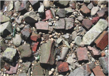
Beach Debris at Buzzard Point
DECUMANUS MAXIMUS
The decumanus maximus of L’Enfant’s imagination was more completely realized than the cardo maximus by the fortuitous intervention of that twitch of Empire, the McMillan Plan of 1902. The great east-west axis is appropriately bounded by a Greek temple (Lincoln Memorial) and a Roman stadium (RFK). Between them: the Mall, the Capital building (depixilated in Google so as to avoid detection), the slightly misplaced monument to Washington, a mute stele rising abruptly out of the grass with an inscrutably tiny door, and the grossly rhetorical and hugely out of place WWII Memorial (Why J. Carter Brown was convinced of the appropriateness of this as the “last” great monument in the constellation of monuments that represent the founding principals of the nation deserves more serious scrutiny).

RFK Stadium
East of RFK Stadium, the McMillan Plan never quite got around to extending the axis across the Anacostia, nor did the alignment exactly correspond to the easternmost corner of the ten-mile square, although the 1901 Plan did dredge the upper Anacostia marshes into a well-defined canal as part of an antimalarial campaign. East Capital Street bifurcates around the stadium, jumps the Anacostia and tails away, similarly ignoring the lay of the ground, riding up and over a topography of old ravines tamed by the requirements of a weakening axis, a final long hill that was for years breasted by the notorious housing block East Capitol Dwellings (where Marvin Gaye grew up) just behind the crest that must have had spectacular views from its broken windows. The new low-density HOPE VI financed replacement housing, Capitol Gateway Estates, look like little more than a Potemkin Village of some image of middle-class suburban ideal.
The easternmost corner of the District is marked by a surveyor’s stone dated 1792 in another trashy weed lot of breeding poison ivy a few blocks off the misaligned intersection of East Capital Street with Southern Avenue. Neighborhood kids must regard the little monument as a useless relic in a dumping area or a stone that fell from the sky or a vaguely religious site long forgotten. The boundary stone in ancient Roman culture did have religious significance and all the associated ceremony. Andrew Ellicott and Benjamin Banneker, of myth, the act unrecorded, must have found themselves in a trackless land grant. Working the angles divined by Congress, they must have set the heavy, ungainly boundary stones from a wagon. The interpretations were made elsewhere, the spot unrecognizable and now as lost as it was then.
The perpendicular cuts through the woods point exactly northwest and southeast. This lower section of Eastern Avenue looking back to the Anacostia has same disregard for topography, bounded by modest homes on either side, nearly unchanged since they were built half a century ago, those types of homes with successive permitless additions, an empty thoroughfare having forgotten its reason long ago.
The hill bottoms out in an industrial section, but before having to deal with the Anacostia and the bother and expense of a bridge. Kenilworth Avenue conveniently provides an excuse to sever this section of Eastern Avenue from its extension on the other side of the Anacostia where it bifurcates Takoma Park. The marshland below extends to the banks of the river. Once owned by a maimed Civil War veteran, W. B. Shaw, employed for a time at the Pension Building, he fell into the business of cultivating water lilies on his near worthless marshland. His descendents resisted the efforts of the McMillan Plan to dredge the marsh and seem to have extracted, as an agreement, the conversion of the property into two parklands. One, is Kenilworth Park (700 acres), the other the rarely-visited Aquatic Gardens (14 acres). Both of these departmental properties of the National Park Service are down-listed into the status of an unfunded mandate and cut adrift for “volunteer” maintenance.
At the Aquatic Gardens any hierarchy among the buildings that might indicate the original Shaw family house is lost, and the diminutive information center, classic brown “National Park” is open but empty. Desiccated exhibits of native plants , populate a narrative of marsh restoration, the undoing of a turn-of-the-century McMillan Plan anti-malarial campaign. Obediently walking the designated path, bush-hogged to keep the weeds down, the designated markers and information plaques have been vandalized by local fauna. The first view is of a swath of splintered trunks, broken half-way up, entire canopies thrown down and reduced to tangles of grown-over branches at ground level which open great holes to the sky. At the end of the path you can see one of the efforts of marsh restoration was to punch holes in the stone walls that were constructed to constrict the waters to a canal-like perfection. The resulting mud flats now attract birds and theoretically should filter the oily run-off from suburban Maryland parking lots, and cleanse the notoriously fetid backwater.
MY LORD’S ISLAND
Now, run down the axis by lining up the center line of RFK Stadium, the Capital, and the Lincoln Memorial (the stele of the Washington Monument is slightly off set), and see where you end up on the other western extreme: a couple of immature trees on the banks of the Virginia side of the Potomac below the tip of Roosevelt Island, near Arlington Cemetery, at the 17 milepost of the Mt. Vernon Bike trail, and within hearing of the Roosevelt 66/50 Bridge: The edge of suburban Virginia.
The high buildings of Roslyn, Virginia just to the north affront the dignified background view of the Lincoln Memorial such that 25 years ago an informal agreement mediated by the U.S. Commission of Fine Arts limited the height of the buildings. Today the agreement seems undone with immanent development of even higher structures. A new Memorandum of Understanding has been written to give an appearance of a negotiated agreement between equals but it is little more than a grudging acknowledgement of economic realities. Height limitations in the District force developmental pressure upward exactly at the jurisdictional borders. Roslyn occupies the closest and most valuable nestle of unregulated ground where the views are a sought after commodity.
The view from this spot is delightful. It embraces the picturesque banks of the Potomac, a portion of the city, and an expanse of water, of which the bridge terminates the view. Numerous vessels ply backwards and forwards to animate the scene. Directing the eye over a corner of the garden, we perceive the sails only, as if by enchantment, gliding through the trees.
— David Baillie Warden, A Chronological and Statistical Description of the District of Columbia, Paris, 1816, pp. 137138
I could not find the spot on the island ridge where the ruins of the summerhouse should have been. Photographs shot in the 1930’s reveal an almost Mayan-like ruin, grown-over in roots and jungle. Summer home of General John Mason, the 90 acre island was owned by the Mason family for generations. Earliest records refer to the island as “My Lord’s Island” and then , after 1680 as “Barbadoes” After 1717, when the Mason family acquired the property, the island was commonly referred to as “Mason’s Island” John Mason renamed it “Analostan Island” and built the house and gardens during the 1790’s. A prominent social life developed on the island, which was now cultivated in orchards and “had an able English gardener in charge of the estate for many years”. In 1798, Louis Phillipe, Duc d’Orleans, who would be the last king of France, politely wrote of his visit that “he had never seen a more elegant entertainment”. In 1805 a causeway was built from the south shore in response to the silting up of the Georgetown harbor on the opposite bank. The thought was that by forcing the flow of the Potomac into a more restricted channel, the river would naturally scour a channel for ships. Instead a stagnant backwater developed behind the causeway that diminished the summer pleasure of the island (with clouds of mosquitoes no doubt). By 1833 financial problems forced Mason to sell the island and for the next century it suffered a succession of owners, commercial cultivation, dance halls, and gradual abandonment.
In 1931 the Roosevelt Memorial Association bought the property and commissioned what is today widely regarded as a dreadful monument to our 26th president, Theodore Roosevelt. Completed in 1967, and genuinely not worth the wait, it is another one of those scarcely visited National Parks. The circular space of the monument actually occupies a relatively small portion of the island, where a stiff sculpture of Theodore Roosevelt, one hand raised in heroic style, the other beckoning, recalls simultaneously a recently deposed Middle Eastern dictator and a gesture of bribery, except that he appears to be orating harmlessly at the trees. The raised gesture should have been recognized by 1967. Four monumental stone tablets similarly orate strenuously on NATURE, MANHOOD, YOUTH, and THE STATE to the trees. That Frederick law Olmstead, Jr. was the landscape architect suggests either a very insignificant project or one that has been allowed to disappear into the weeds. The unforgivable intellectual laziness that allowed the rest of the park to return to a state-of-nature is insufficient cover for simple neglect. The sad proof is here, inadequate funding, and the political reality that, without a vote, the District is always last on the list. While there is some charm in walking the pathways, the constant wall of white noise from the Roosevelt 66/50 bridge on one side and the George Washington Parkway on the other, tends to render the effort to distinguish birdsong a quaint endeavor, not to mention the thunder of incoming planes banking down that twisted trajectory into National Airport and the Doppler menace of military helicopters ranging through their tight flight paths just above the branches.

Analostan Island from Map of the City of Washington, Robert King
Ruins of General John Mason House, Analostan or Roosevelt Island

Bronze Statue of Theodore Roosevelt by Paul Manship
“Conservation means development as much as it does protection”. Thus reads the tablet on NATURE. Congressman Dick Pombo, 11th District of California, should probably have made some reference to Roosevelt’s words before working up the 2005 Draft Reconciliation Bill, Subtitle C, Section 6307, which would have sold Roosevelt Island among another fifteen parcels in the National Park System for the “purposes of commercial and residential development.”
There is potential in the idea, but suspicion in where the House Resources Committee got it. The reaction to an image of “strip malls and [new urbanist] townhouses” (probably not that unlike the Capitol Gateway Estates) was as predictable as it was effective in stripping the language from the bill. That the pressure to include it from the bill likely came from landed interests in adjacent Roslyn speaks of a genuine worry of intention. Perhaps strip development was the limit of their imagination.
A more enlightened proposal should take the “le de la Cité” in Paris as a model, or Venice, or even the artificial islands in Miami. Why, in the center of such a growing conurbation as the tri-state metropolitan area, should density be so restricted that it only reinforces growth into exurbia? A better objective would include this parcel in the package of federal land holdings that should be ceded back to the District government, which in turn should hold an international architectural competition for urbanization of the island. Tax revenues on the 90 acres could contribute significantly to the city treasury as it could contribute to the population of the District. A portion of the island could remain as an urban park with sufficient funds to adequately maintain it. The Roosevelt sculpture could be shipped to the Adirondacks and left gesturing at the mountains.
UNMARKED
At the far northwest corner of the District, the ragged edge of the tilted frame, where the Potomac once penetrated the geometric perfection of the 10-mile square, the border is unmarked. The waters flow regardless of jurisdiction, the landscape disregards such enlightenment rationality. At The C&O Canal Lock #5, just outside the limit, the National Park Service has installed a standard-issue information kiosk with a worn red sticker “you are here” adhered to a sun-shot fiberglass map. No indication of where you are relative to anything other that the immediate mandate of the park, not even an indication of where the District line is. At the bottom edge, a new sticker of a slightly different standard blandly requests information on any suspicious activities and displays a District number like an antigen.
Earlier in the day a heavy motorcade of armored black limousines fronted by police bikes and followed by black SUVs with machine guns casually pointed at sidewalk gapers. A flashing white ambulance followed like a pathetic hanger on. The number is posted everywhere but it is understood who gets the real protection, the layered defenses, the bounded enclave, the force protection.
Almost exactly across the river is the Fort Marcy Park, where Vince Foster was found dead on July 20, 1993, and provoked right-wing paranoid speculations about a vast left-wing conspiracy centered in the travel office of the Clinton White House. A bit further north Mir Aimal Kansi killed two and wounded three CIA employees outside CIA Headquarters on 25 January 1993. The brown and green landscape of steep, wooded ravines is indifferent, undifferentiated and unmarked by these intimately human events that generated silent reverberations that are still echoing in the thickets of law, language, and response. The Three Mile Northwest Boundary stone has been lost somewhere in these woods.
Earlier manifestations of the autoimmune response include one of the interlocking wheels of paranoia that surround the Kennedy assassination. On 12 October 1964, Mary Pinchot Meyer was shot dead as she walked along the Chesapeake and Ohio towpath in Georgetown. A favored mistress of JFK, former wife of a high official at the CIA, her diaries were of particular interest and have also generated a cottage industry of endless paranoid speculation. Even on the patrician side of a well-ordered Washington, the suspicion lies just beneath the surface of a hidden order or a ragged edge to the law where boundaries are unmarked and jurisdictions unclear, where given the right circumstances and timing things can be done outside the law as necessity might require, necessitas legem non habet.
SHADOWS AND ECHOES IN THE GENETIC CODE
Just down the embankment where Mary Pinchot Meyer was photographed awkwardly crumpled under the professional gaze of a set of assembled detectives and policemen, find the floodplain site of the proposed new Georgetown Boathouse. The University committee charged with task of selecting an architect probably thought it had made a clever choice in Stephen Muse who had been chairman of the Georgetown Historic District Board and was understood to have the necessary depth of experience to skillfully manage the shoals of a complex approval process.
The siting of the building is intended to transform the mental image of the University to a romantic presence in the American landscape akin to Thomas Eakin’s paintings of boaters on the Schulykill, while keeping the Gothic spire of the Jesuit institution in the background, on the crest of the wooded bluffs. The design is predictably 19th century Philadelphia boathouse and loathsomely, even panderingly, conventional. But despite the vociferous opposition to the new boathouse upstream, the Washington Canoe Club which occupies the only genuine boathouse, a picturesque barn settled on unstable foundations, cannot legitimately argue against the presence of Georgetown University on the water, given their own privileged status established a century ago. The legal barricades, the environmental impact studies, the appeals to varying supervisory institutions are well-established legal stratagems of delay and obfuscation grounded in little more than an instinctive resistance to change and simple philistinism. The pandering design, popularly derided as the “bloathouse”, just added to the insult.
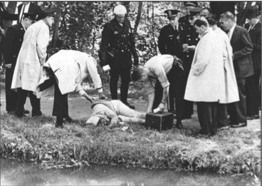
The murder scene on the towpath

Three Sisters Bridge, proposed by Harry Weese and Associates
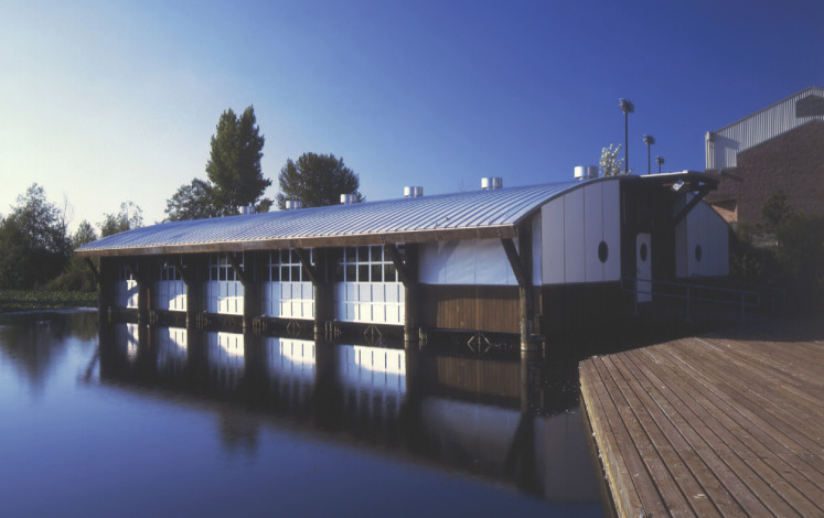
University of Washington, Coaches Boat House, Seattle Campus, by Miller Hull Partnership
That Georgetown University, an institution with deep roots in the permanent national bureaucracy, should propose such a pastiche speaks of an intellectual blindness, institutional cowardice, and a contempt for public opinion that would not allow a more daring and intellectually vigorous design. Were they unaware of the University of Washington’s award winning boathouse by the Miller and Hull Partnership done in 1993? That this inward-turning parochial atmosphere also represents the cultural milieu of the capital city in general may partially explain why no architect has ever emerged from the metropolitan region to international, let alone national, reputation. The preconditions for that emergence, elusive and difficult to define, have never converged and leave a twisting doubt of the capacity of the national elite to understand the world outside their familiar boundaries.
This is a place where the rules are deeply opaque, a Chinatown in need of a Robert Towne script to decode the errors of interpretation in an urban topography which rises to such political heights that every local debate can be expanded in the way that failed relationships are unable to resist resorting to the heavy guns, and every appeal is made to ever more exclusive and shadowy privilege or background historic echo.
The foundation model for such civic resistance is undoubtedly the postwar highway engineering proposals for the District that would have made the Big Dig in Boston look like a routine exercise in civic renovation. The large-scale mobilization and industrialization that World War II had routinized and entrained into the national bureaucracy was unable to respond to the tiny voice of resistance that Jane Jacob’s represented in her writings. However, the legacy of that movement in the genetic code of civic conduct and the now dominant narrative of the historic preservation movement has not provided a viable alternative of its own that deals with the realities of large scale economics. The cult of the matron saint of preservation is little more than empty philistinism now and a more sophisticated critique is desperately required. The remnants of the highway system that the movement managed to stymie, the shrapnel of a social explosion in the city, may be a more damaging consequence than if the highway system had been completed as planned.
The Three Sisters Bridge would have vaulted the river where Spout Run now ends on the south bank of the Potomac, and I-266 would have (as planned by Harry Wesse Associates, designers of the Metro) breasted the north bank where the new boathouse is sited. If not demolished for being in the way, the picturesque Washington Canoe Club barn would have met the same fate as the Fish Market lost under the enormous concrete pylons of I-395. M Street in Georgetown (in a parallel universe) might have, by now, become a pedestrian space rather than the weekend SUV/Hummer choked parking lot of visiting suburbanites it is now.
But most astonishingly the plan for I-266 was for a tunnel that would have begun at that now desolate expanse at the west end of K Street and would have passed under the State Department, the Federal Reserve, the White House, and all of downtown maneuvering deep and hidden under building foundations, secret below-grade passageways, and the then simultaneous excavations for the metro to emerge into the equally desolate expanse where New York Avenue and Florida Avenue cross, and the railroad lines behind Union Station gather under the hill that contains Mt. Olivet cemetery. It would only have taken a slight modification of that original plan by Harry Wesse and Associates to have moved the entrance to the tunnel further back to the Three Sisters Bridge to have preserved the Washington Canoe Club. The money was there, then.
I-266 might have obliterated the neglected ruins of the Aqueduct bridge at the end of the Chesapeake and Ohio Canal Park. The remaining stone arch span serves as a threshold between the park and a state of nature and Georgetown and the refinements of wealth and power. What biker hasn’t stopped to rest on the broken stones that overhang the river and take in the view of the key ridge and the Roslyn skyline despite the fence put up by National Park Service maintenance crews? A little well designed cafe might be just the thing for a thirsty, tired and burr-covered walker.

STATE OF EXCEPTION
By Julian Hunt
[Originally Published in Urban Land, August 2008]
“Some 700 tiny parcels of unusable public land in Washington, D.C., currently are under the administration of the National Park Service. These small urban parcels could be returned to the District of Columbia, which could convert a number of these parcels into small neighborhood parks.”
In the public mind, the National Park Service (NPS) is steward of the sublime, charged with preserving America’s landscapes. Behind the words of the legislation that created the NPS in 1916, the unspoken mission was to protect what little remained of the primordial forest. The etymological origins of the word “forest” might be traced from the Latin foris “outside”, perhaps, in the sense of a place outside or beyond human influence or administration. Nothing of the Earth now remains in its primordial state of wilderness outside human ownership or exploitation, except by degree. There is no place that has not been mapped, cataloged, photographed, and brought within a legal framework. What is “outside” has disappeared.
The real estate portfolio of the National Park System contains not only properties of the most iconic beauty and historic significance, but also a small and growing collection of curiously unclassifiable miscellany, the odd donation, and unwanted properties shunted into the back files of the NPS. This last classification includes properties held in public trust from well before the foundation of the National Park Service, with a particular concentration in the District of Columbia. Some of the oldest federal lands delineated by French architect Pierre L’Enfant’s plan back in 1791 for the layout of Washington ended up in the NPS portfolio in 1933 after a long succession of transfers.
Located beyond the National Mall, which stretches two miles from the U.S. Capitol to the Lincoln Memorial, these miscellaneous properties in the District of Columbia are particularly distinctive because of their urban setting and arrangement. Urban parks within the National Park Service portfolio do exist, most notably the 75,000-acre (30,352-ha) Golden Gate National Recreation Area in San Francisco and the Gateway National Recreation Area outside New York City, but they are still characterized and used largely as natural landscapes.
Excluding the National Mall; Rock Creek Park, the 12-mile-long (19-km) urban green area that bisects Washington; and a ring of old Civil War fortifications, the District portfolio is made up of a constellation of circles and squares that mark the junctions of important diagonal avenues of the L’Enfant Plan, inspired by the urban squares of Paris. In his role in the design of the District of Columbia, statesman/architect/naturalist Thomas Jefferson left some enigmatic notes that suggest he was doubtful of the utility of the diagonal avenues as he was of the competence of L’Enfant himself. The few extant sketches in Jefferson’s hand, snippets of an urban DNA for the design of the city of Washington, reveal a preference for orthagonality as Jefferson had previously shown in the Land Ordinance of 1785, which established the basis for the Public Land Survey System- the one-square-mile grid laid out over the continent.
The contradictions involved in implementing an urban plan based on the French Enlightenment and driven by concentrated royal power- in a land that was little more than an enormous wilderness- by a fledgling and decentralized federal government has bedeviled the urban history of the District of Columbia. The subsequent subdivision of the ten-squaremile federal district, after L’Enfant’s dismissal, was managed by three appointed federal commissioners who arbitrarily deviated from many aspects of the L’Enfant Plan. It could be argued that their careless misapplication of the plan resulted in the many tiny triangular fragments left over from the unresolved intersections of L’Enfant’s diagonal avenues with the orthogonal street grid. However, it has been rare to find a building with a well-resolved corner on any of these diagonal streets, suggesting a general lack of interest in the necessary design effort and funds to resolve these unusual geometries.
Triangle Park on Q Street NW and Connecticut Avenue NW
Whatever their origin, nearly 140 years later, hundreds of these tiny fragments of unusable public land fell under the administration of the National Park Service. Today, they constitute some 700 tiny parcels of little more than concrete traffic peninsulas and islands. Lady Bird Johnson, who initiated the 1965 Highway Beautification Act, may have had these eyesores in mind. For a period of time, some effort was made to maintain these sites. However that effort eventually seemed to wane and has been long forgotten, leaving the triangles to revert to their natural state of neglect and ruin.
While the administrative procedures for large parcels of parkland are defined by the 2006 NPS management policies in reasonable detail, a more specific policy for small urban parks is nonexistent. In a chapter devoted to neighborhood parks in her seminal book The Death and Life of Great American Cities, Jane Jacobs noted that parks by themselves do not make a neighborhood, but that the neighborhood makes the park. The NPS mission to preserve and protect was never intended to cover the administration of very small urban parcels, which require detailed knowledge, attention, and understanding of surrounding neighborhoods at a level that a large bureaucracy, such as the National Park Service, is unable to render.
The particular case of the fragmentary constellation of tiny parks in the District of Columbia is further clouded by the anomalous status of the District as the only jurisdiction in the United States without a vote in Congress, leaving the District in a peculiar state of exception with regard to its relationship with the federal government. Where the management of the urban parks of New York and San Francisco can be overseen by citizen activism and the constituent services of an elected local member of Congress bringing attention to a jurisdictional matter, the responsibility for the parks in the District is diffused and without the critical feedback mechanism of the vote. Historically, Congress as a body is responsible for the administration of the District, but constituent interests lie elsewhere. This diffusion of responsibility is obscured by a deployment of independent and uncoordinated federal oversight commissions, planning bodies, and preservation boards.
Dupont Circle, the most famous and popular of the L’Enfant circles, is populated with splintered benches, and isolated by a traffic plan that makes crossing to the park an exercise in jaywalking.
Thomas Circle marks the transition to downtown from the residential neighborhoods just to the north. A circle badly disfigured by traffic engineers in the 1960s, it was recently renovated to an unsubstantiated historic form that makes no acknowledgement of the vitality of the changing neighborhood. Fake historic aluminum picket fences; standard issue concrete walkways; a new archipelago of traffic islands that provide no aid, shelter, or thought of the pedestrian; an incoherent array of light poles to illuminate traffic; and a lonely equestrian statue of the Rock of Chickamauga.
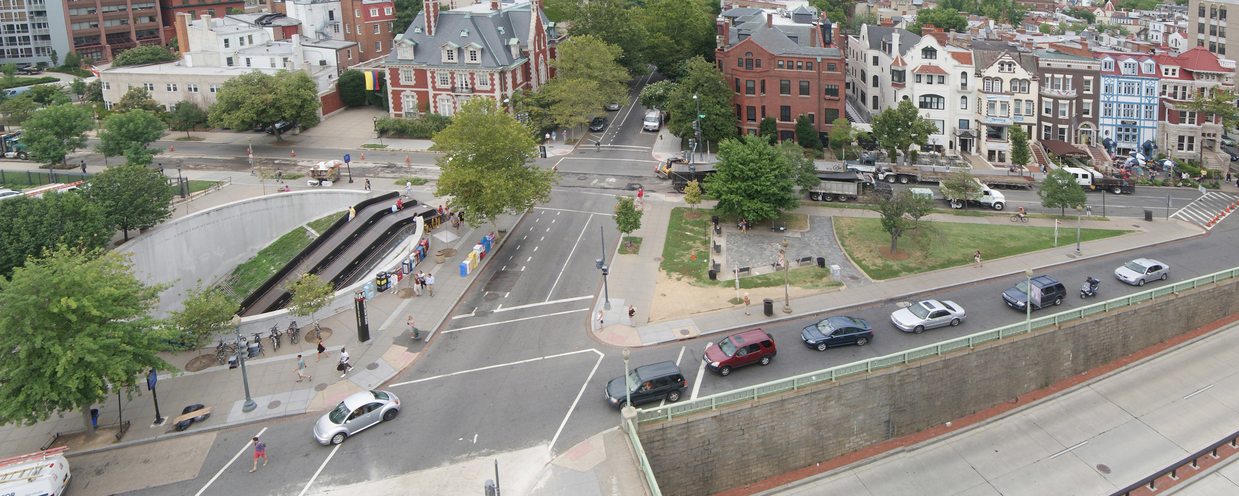
Reservation 149 (the smallest properties are designated by number; “reservation” refers to the old military designation that has since developed an entirely different meaning), a dilapidated triangular park near Dupont Circle was recently the object of neighborhood attention. A new sophisticated design, to be paid for by private money, that acknowledged the presence of both the popular spontaneity of the Dupont Circle Farmers’ Market and the iconic design of the Dupont Metro entrance, was summarily rejected by the NPS Special Assistant for Partnerships. The design was arbitrarily replaced by an insipid revival from records of a 1929 plan, a period when neither the Metro nor the farmers’ market existed, and the immediate urban environs were entirely different from those of today. This offers a stark contrast to a similar traffic island recently renovated in Manhattan at 14th Street and 9th Avenue.
There are legions more of small urban parcels that document a dysfunctional stewardship that has allowed an administrative state of exception to reign over the District of Columbia. Without political influence to defend its interests, the District of Columbia stands 51st in a line of 50 states for funding responsive to its needs. Who would want to administer some 700 triangular fragments of mostly useless real estate that now function as little more than traffic islands? These lands do not contain magnificent stands of Sequoias, virgin Hemlocks, glacial melt water, salmon runs, or any endangered species except a form of extremely rare habitat- open space in the nation’s capital- the connective tissue that supports public life.
Despite internal resistance from the National Park Service to transferring any kind of property from its stewardship, and specific resistance to transferring any property that might be associated with the L’Enfant Plan, the long history of the upkeep and maintenance of the triangle parks shows one of negligence. Ultimately, the 700 or so triangle parks do not belong in the NPS portfolio. They should, instead, be returned in their entirety to the District. A precedent for this transfer is the recent Federal and District of Columbia Government Real Property Act of 2006, which transferred a discrete set of properties for the development of the Anacostia Waterfront Initiative and could be regarded as a first step in a sequence of transfers.
Before such a transfer of properties can be justified, however, the District of Columbia government must provide a coherent management plan for their development and integration into their specific neighborhoods. The recent deployment of neighborhood “design charrettes” by the D.C. Office of Planning represents an improvement, but it is insufficient to render coherent designs.
A more successful model was developed in Spain during the transition to democracy after the Franco years. In the intense public debate over the meaning and deployment of a new democracy, a model of urban renovation was devised that allowed neighborhoods to define their needs while creating a method to introduce the necessary expert opinion into public discussion.
A form of parliamentarian democracy, which brought bottom-up neighborhood design charrettes to frame the problem, as well as a professional response in the form of architectural competitions, produced an impressive variety of proposals for public discussion. The effect was to deepen public understanding of the critical character and possibilities of public space, in stark contrast to the aimless drift so evident in the management of public space in the District.
This method was particularly successful in Barcelona, Spain, which renovated tiny neighborhood parks, known as “hard” parks for their use of stone paving. The widespread architectural competitions had the additional effect of stimulating the growth of a whole generation of innovative architects, who have since led the city to international recognition.
The District could follow this model at the small scale of the triangle parks and at minimal financial risk. To do so would provide the District of Columbia with the potential to put itself back on the map as a place of architectural innovation- free of bureaucratic stultification.
THE WHALE HAS NO FAMOUS AUTHOR
Thoughts on the
District of Columbia