


ComMass is a series of analytical and illustrative works to better understand commuting in Massachusetts and propose ideas that advance the transit-oriented development and improve the public space. The displayed work reflects on transportation, mobility, connectivity, and accessibility, ranging from the county to the block level.
Middlesex
These maps display the different modes of commuting in Middlesex. One can observe that the more peripheral an area is, the higher the concentration of residents commuting by car, especially of those driving alone. The use of public transportation is primarily concentrated in central areas, where there are more walkers. While this aspect is a characteristic of urban areas, there is an additional consideration for this county: many commuters are students living around universities that prefer walking or riding a bike.
Boston-Cambridge
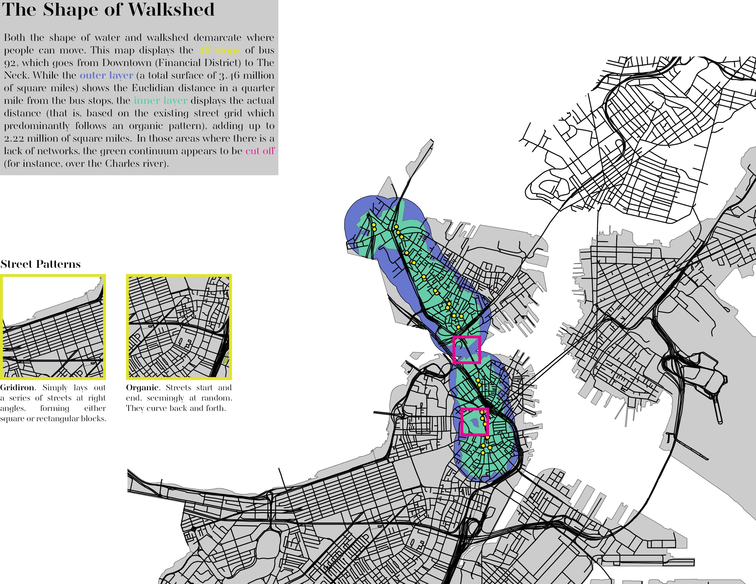
A natural barrier such as the Charles River between Boston and Cambridge or the manmade urban planning affects the accessibility to the transportation system. When actual data is not available, the Euclidian distance, also called “naïve”, is useful to estimate distances to a certain point. However, this methodology always overestimates the real walkshed, which is also affected by different street patterns.
South Boston
Bridges, routes, and highways have played a critical role in improving connectivity. While some of these kinds of big civil engineering projects have become iconic representations of the urban landscape, others have disrupted the public realm, creating blight, segregation, and exclusion. As part of the freeway removal, the Central Artery of Interstate 93 was rerouted and the Rose Fitzgerald Kennedy Greenway was built on land previously occupied by the John F. Fitzgerald Expressway.
Andrew Square
Local governments can use land value capture as a policy to recover and reinvest the increase in land value as a consequence of public interventions. In some low-density areas, authorities can implement a zoning tool called “density bonus” that allows developers to build taller or increase density in exchange for public benefits. “We care about the square” is a project to promote transit-oriented development and improve the physical and social infrastructure around an existing metro station. Thus, the funds obtained from the density bonus program could finance new green areas and public spaces, expand the bike lane network, organize cultural activities, hire local artists for murals, or create a revolving loan fund so small businesses can, for instance, install parklets and increase their profits.